The plan to connect every British town

 john finney photography/Getty Images
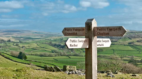
GPS has mapped the fastest way to drive, cycle or bus between almost anywhere, yet there was no map showing how to walk between Britain's cities and towns – until now.
There was a time when the thought of walking made me shudder.
I grew up in Merstham, a one-pub village in England's south-east that sits on the motorway border between London and Surrey. My school was at the top of a wooded hill, accessible to vehicles only by two narrow country roads. But my school commute, a journey where I was more likely to encounter a bushy-tailed squirrel than another human being, was a little different.
Most days after class, I would swap my school shoes for mud-encrusted wellies, watching with envy as my friends were whisked away in their parents' warm, dry cars. My mum was working long hours in the city and there were no public buses plying the school's narrow access roads, so I had two options: walk the two-mile bridleway that connected my village to the school; or wait until dinnertime to be picked up. The decision, despite having to trudge through shin-deep mud for 40 minutes, was an easy one.
 Jessica Vincent
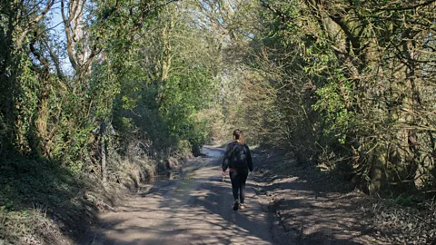
Fast forward 11 years and I was once again squelching through a muddy English footpath, only this time I was doing it for fun. It was a crisp Saturday morning without a cloud in the sky and, with few other activities available under Britain's third national coronavirus lockdown, I'd set out to explore my recently adopted home of West Sussex on foot.
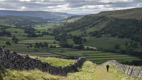
The county is well known for its beautiful National Trails, like the 100-mile-long rolling chalk hills of the South Downs Way and the windswept Seven Sisters cliff walk. But having hiked both before, I wanted to try something different. Instead, I would use the Slow Ways map – a new national network of walking routes that will soon connect every town, city and thousands of villages across Britain – to walk between Storrington and Worthing, a 10-mile route that would take me from the northern foot of the South Downs to the sea via the medieval village of Findon.
"You'll be the first to walk this route," said Daniel Raven-Ellison, a geographer, National Geographic Explorer and the founder of Slow Ways. "You must know that everything is -generated and yet to be tested, so you'll be the guinea pig."
 R A Kearton/Getty Images
In an age when GPS has mapped the fastest way to drive, cycle or bus between almost anywhere, there is no map showing how to best walk between Britain's cities and towns. Despite Britain having thousands of public footpaths, Google Maps often leads pedestrians alongside A-roads or through private property, while walking apps usually avoid the most direct route in favour of more scenic and remote trails. In short, planning an intercity walk in Britain was, for most, more hassle than it was worth – until now.
In January 2020, Raven-Ellison put out a call on social media for volunteers to him at an Geovation hack day in London to help with his most ambitious mapping project to date. Using existing public rights of way, the Slow Ways map would create a national slow highway showing people the safest, most direct and most enjoyable way to walk between anywhere in Britain.
"[The British] culture around walking means we travel on foot mostly for recreation," Raven-Ellison told me. "But what if we started using our incredible network of footpaths to walk further, more often and for more purposes">window._taboola = window._taboola || []; _taboola.push({ mode: 'alternating-thumbnails-a', container: 'taboola-below-article', placement: 'Below Article', target_type: 'mix' });